
Preservation in Peril: The Fales Edgarton House
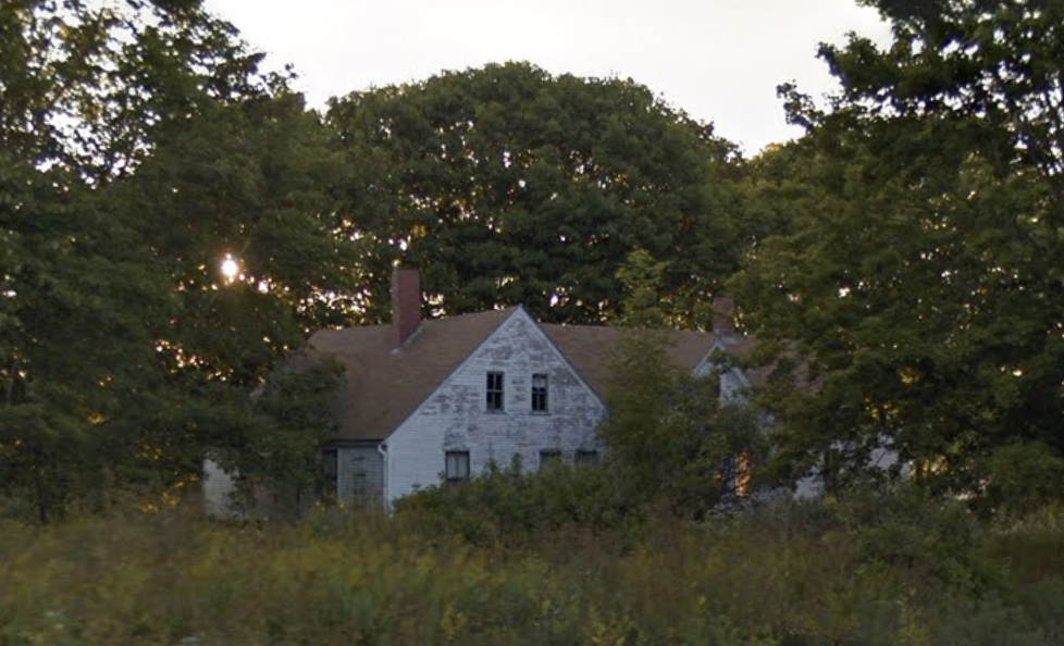
Sometimes, the history of a house is well known locally, but unless you have the name of the original owner or the town’s nickname for it, information can be hard to ascertain. Such was the case for the Fales Edgarton House. While for years, I passed the home on the road from Thomaston to St. George in mid-coast Maine, I never really paid much attention to it. It was to me just one of the numerous indecipherably old homesteads encrusted in decades, if not centuries, of white paint, whose composition followed the old New England children's rhyme “Big House, Little House, Back House, Barn.” (As an aside, if you want to learn more about this vernacular style, I recommend Thomas Hubka’s book of the same name, as his writings on the American ranch house were of great assistance for my thesis.) Over time, however, the residence distinguished itself from other connected farms, as the style is called, through its abandonment and rapid decay.
As the decline occurred, I tried to find out more about the property, but a cursory search of the address turned up nothing, so as always, I sought out historic maps of the area. The house was initially hard to locate due to the fact that High Street, on which the house is located, was altered during the construction of nearby Route One in 1926. Further complicating the matter, beginning in 1929, several buildings opposite the residence in question were demolished during the reconstruction and later expansion of the General Henry Knox Estate, Montpelier. This included the demolition of the old meeting house constructed in 1795 and labeled “Bapt ch” on the map below. It was pulled down and the land incorporated into Montpelier due to safety concerns in the mid-1960s, contributing to the stark contrast between the 1855 map and the 2025 aerial view.
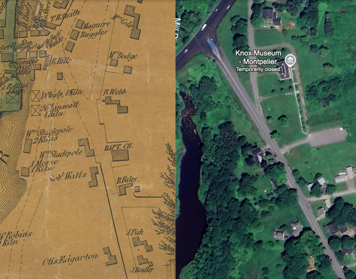
D.S. Osborn and E.M. Woodford, “Map of the town of Thomaston”, 1885, Maine Memory Network, https://www.mainememory.net/record/105434. Accessed 19 October 2025.
The 1855 map of the village of Thomaston, a portion of which can be seen above, also provided me with the information needed to learn more about the history of the house itself. Namely, the Otis Edgarton house at the bottom of the map corresponds closely in location and layout to the abandoned homestead of interest, which is the brown asphalt-roofed structure at the bottom of the satellite image. Further corroborating this identification was a 1878 panoramic map of Thomaston, which showed a home correlating to the Edgarton property on the previous map that resembled the present-day homestead (center residence below).

William E. Rivers, “Birds Eye View of Thomaston”, 1878, University of Southern Maine, https://digitalcommons.usm.maine.edu/oml-maine-birds-eye-view-maps/3/. Accessed 19 October 2025.
The name Otis Edgarton laid bare the residence's whole history and current sorry state. A 1865 history of Thomaston, written by one Cyrus Eaton, listed Edgarton as having been born in Lancaster, Massachusetts in 1797, and marrying Mary Fales, the daughter of a Thomaston marble manufacturer, in 1823. The combination of the names Fales and Edgarton, of course, led me to the Fales-Edgarton House, which the Thomaston Historical Society lists as still standing at 59 High St, the address of the abandoned homestead. (It is unknown why the house did not appear in my original search for the address.) Indeed, a 1870 photograph of the Fales-Edgarton house is easily identifiable as the present-day structure. According to the Historical Society, the home, believed to be the oldest surviving in town, was built in 1786 by David Fales Jr., Mr. Edgarton’s father-in-law. The latter raised his family in the residence while working at the marble mill on nearby Creek River. The home was eventually sold to the Hastings family of Warren, Maine, and later to the Fernald sisters in the early 20th century, who occupied it for 70 years.

“Fales Edgarton House”, 1870, Maine Memory Network, https://www.mainememory.net/record/27973. Accessed 19 October 2025.
A 2019 story by the Penobscot Bay Pilot, on the home’s edition to Maine Historic Preservation’s Endangered List, indicates that the path to the house’s abandonment began in 1995 when a retired couple, the Roebkes, purchased the property. The couple occupied the house until 2007, when they passed less than a year apart. Since inheriting the property, the couple's daughter has been unreachable, displaying no interest in it, and only paying the county taxes every three years. The home's barn, 223 years old at the time, collapsed due to neglect in 2009. Today, the house stands with windows broken and doors falling off their hinges, slowly succumbing to the elements.